Ancient Civilization
Mexico's INAH Says Puebla Site Held a 2,500-Year-Old Solar Observatory; Outside Expert Questions the Label
By Darrell Wallen
Would you prefer to listen?
Mexico's National Institute of Anthropology and History says a Group E complex at Teteles de Ávila Castillo, Puebla, worked as a solar observatory more than 2,500 years ago, the first outside the Maya area. The claim rests on layout and alignments; the announcement gives no radiocarbon date or alignment measurements, and one outside specialist says the word observatory is not entirely justifiable.
§ 1What was announced
Mexico's National Institute of Anthropology and History, known by its Spanish initials INAH, said on October 13, 2026, that an architectural complex at the archaeological site of Teteles de Ávila Castillo in the Sierra Norte of Puebla worked as a solar observatory more than 2,500 years ago. The institute's bulletin, number 471, says it is the first such complex recorded outside the Maya area. It also describes the complex as the oldest of its kind in Mexico.
The claim comes from the Teteles de Ávila Castillo Archaeological Project, directed by INAH archaeologist Alberto Diez Barroso Repizo of the INAH Puebla Center. The bulletin says the conclusion rests on comparative analyses of Mesoamerican urban planning. It says the complex follows the layout of a Group E, a type of ceremonial plan first described at the Maya site of Uaxactún in Guatemala.
This story is filed as a claim. The label Confirmed. appears in the text only where a statement rests on a published source that goes beyond the project's own interpretation. The label Claimed. marks what INAH and the project director say. The label Interpretation. marks reasoning added by this reporter or by outside scholars. Spanish-language quotations are translated by this reporter.
Confirmed. INAH issued the bulletin on October 13, 2026. The Mexican Secretary of Culture, Claudia Curiel de Icaza, is quoted in it. The bulletin says a conference and a photographic exhibition about the finding were held at the site the previous weekend, with support from the municipal government and the civil association Tzoncoyotl.
Claimed. The complex worked as a solar observatory, dates to the Middle Preclassic period between 1000 and 600 BCE, and is the earliest such complex recorded in Mesoamerica outside the Maya area. Each part of that statement is examined below.
Interpretation. The Slovenian archaeoastronomer Ivan Šprajc, who was not involved in the project, told The Art Newspaper that the common practice of calling such complexes observatories is not entirely justifiable. He says their primary functions were ceremonial or residential.
§ 2The site and the project
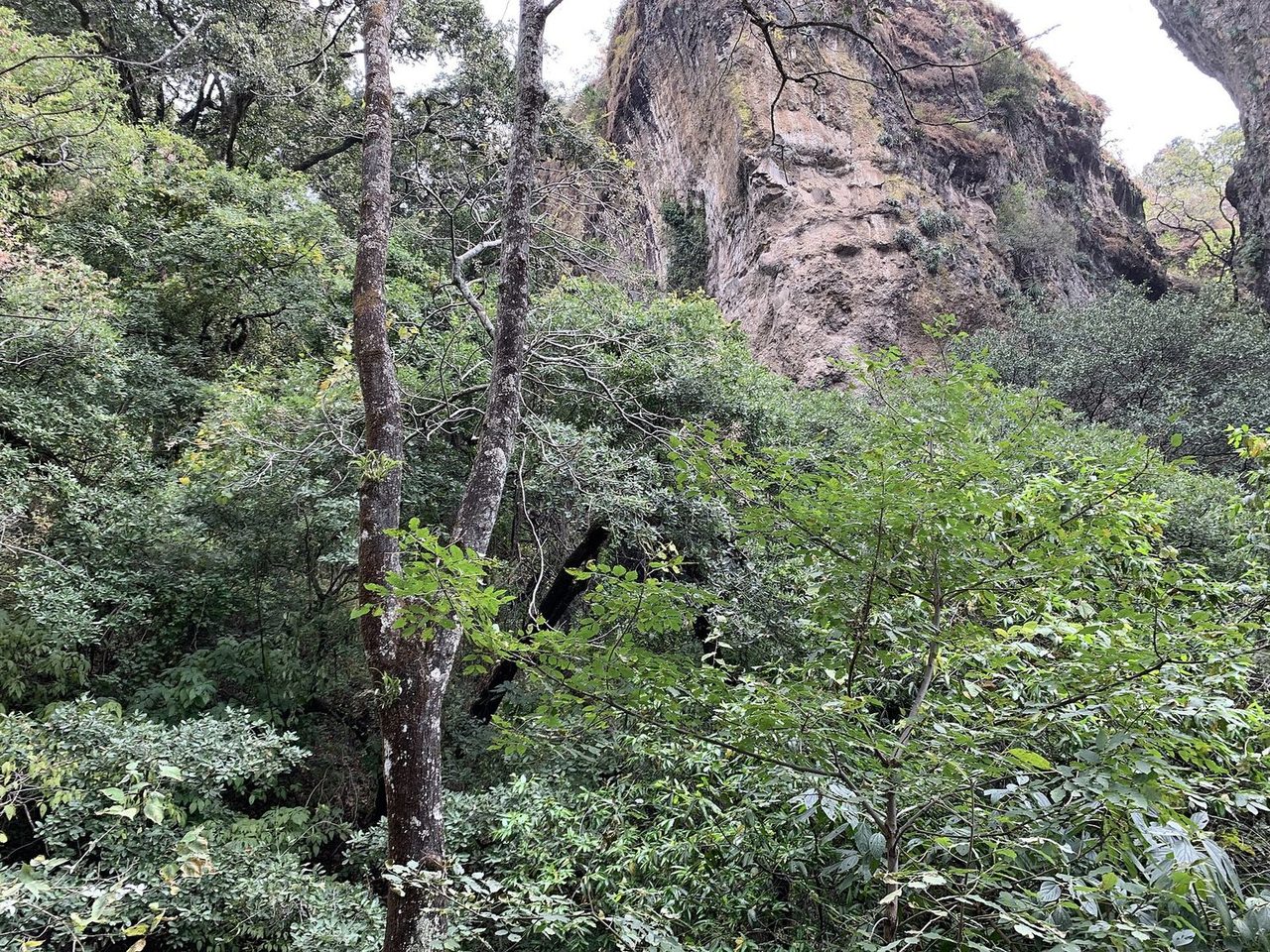
Teteles de Ávila Castillo is both a municipality and an archaeological site in the far east of the Sierra Norte de Puebla. In an article published by INAH's journal Arqueología in 2017, Diez Barroso Repizo describes the area as lying at an average altitude of 1,865 metres above sea level, with pine and oak vegetation and a temperate, humid climate with rain through the year. The municipality borders Yaonahuac and Hueyapan to the north, Tlatlauquitepec to the west, Atempan to the south and Chignautla to the east.
Locals call the site Los Cerritos, "the little hills," or Tetelictic. The name Teteles comes from the Nahuatl root tetel, which INAH's 2024 bulletins translate as mound.
Confirmed. The site was first mentioned in print in 1939 by Vicente Lombardo Toledano, whom INAH describes as a philosopher, politician and union leader from Puebla, in a work on the languages of the Sierra Norte de Puebla. INAH's 2017 article says the site then drew little attention from researchers for decades. It was officially registered with INAH in 2000, and its protective boundary was completed by 2006. In 2007, the owner of a plot covering about half the site donated it to INAH. INAH's 2022 article says the first systematic work, a salvage excavation in 2014 supported by Tzoncoyotl, led to the formal project, which has run since 2015.
The land history is reported differently across INAH statements and press coverage. The 2017 article says the owner of about half the site donated the land in 2007. INAH's 2022 article says a little under half of the area of archaeological potential, more than three hectares, belongs to INAH. The Art Newspaper reports a nine-hectare site, with 3.5 hectares donated to INAH in 2007 and the rest still in private hands, which limits excavation. INAH's March 2024 bulletin refers to a 12-hectare plot donated by Tzoncoyotl. These accounts have not been reconciled in the sources available, and this story does not rely on any single area figure.
Confirmed. INAH's published descriptions give the site about 16 pyramidal platforms of different sizes grouped around plazas. A 2017 survey found at least eight architectural groups with 14 visible structures between 2 and 15 metres high. By 2022 the project counted 16 platforms, six plazas, a sunken patio and what it called a probable ballcourt. INAH says the layout is oriented 15 degrees east of magnetic north and lines up with the surrounding ridges. The Sierra de Chignautla lies to the east and Cerro Colorado, which gives its name to Tlatlauquitepec, lies to the west.
The project's other finds are modest and are described in its own publications. The 2017 article describes three burials of infants, each in a pair of clay vessels placed in the periphery of the site, with tiny obsidian flakes and one small piece of green obsidian. It reports many obsidian flakes, blades and projectile points, mostly of dark grey to black obsidian that the author says probably came from the nearby Oyameles deposit, with smaller amounts from Pico de Orizaba and, rarely, green obsidian from the Sierra de las Navajas. INAH's 2022 article says this abundance suggests the settlement lived largely from making obsidian tools, and that it may have had some control over the nearby sources.
Interpretation. The Art Newspaper quotes Diez Barroso Repizo as saying that green obsidian beads found in offerings with infant remains suggest connections with Teotihuacan, and that the site lay along an active trade route. These are the project director's readings. The 2017 and 2022 INAH texts infer the obsidian sources from the type of stone, and no laboratory sourcing study was found in the material reviewed for this story.
Interpretation. One detail from the 2017 article bears on the site's age and layout. A sounding near a structure on the north edge of the site, called Structure C, found the corner of an earlier platform, C1, oriented 46 degrees from magnetic north. The author notes that buildings with a 46-degree orientation have been found mainly in Oaxaca, such as Building L, called the Observatory, at Monte Albán, which he places in the Late Formative. He reads the burial of C1 under the later building, which follows the 15-degree orientation of the rest of the site, as a correction of orientation or a sign that the older building had lost its importance. It is a reading of one trench, and it shows that the site has more than one building phase.
§ 3What an E Group is
The Group E at Uaxactún was excavated in the 1920s. The archaeologists Oliver Ricketson and Frans Blom interpreted it as an observatory for sighting the equinox and solstice sunrises. In the decades since, archaeologists have found a large number of complexes with the same layout, most of them in the central lowlands of the Yucatán Peninsula. They are now called E Groups.
Šprajc described the standard layout in a 2021 paper in PLOS ONE. A typical E Group has a symmetrical plan. A pyramidal temple stands on the west side of a plaza. On the east side an elongated platform runs roughly north to south. The main axis of the complex runs from the western pyramid to the centre of the eastern platform. He writes that in the earliest variant, the La Venta type, the platform has no buildings on top. In the Cenote type there is one building in the middle. In the Uaxactún type, the latest version, there are two more buildings at the ends.
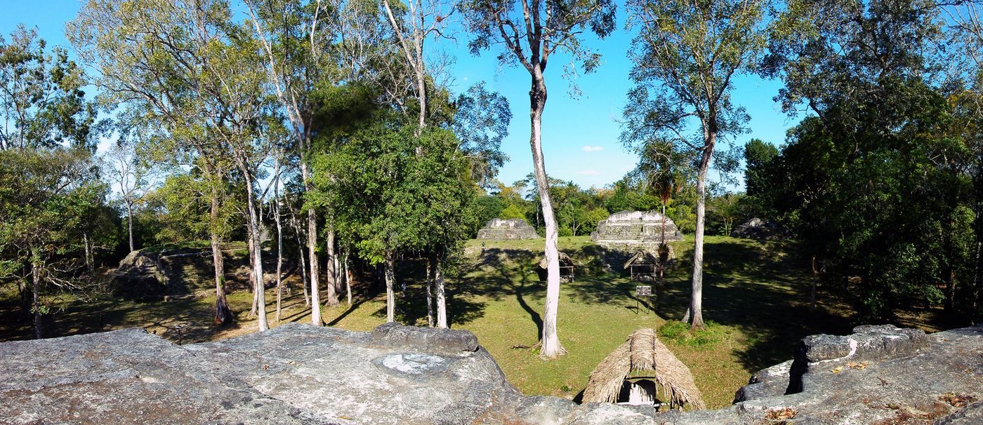

Confirmed. Šprajc's paper, based on alignment measurements at 71 E Groups, says these complexes date largely to the Middle and Late Preclassic and Early Classic periods, roughly 1000 BCE to 600 CE. He writes that the earliest forms seem to have appeared along the Pacific coast and in the highlands of Guatemala and Chiapas. The earliest example he identifies in the Maya lowlands is at Ceibal, Guatemala, whose first stage dates to about 950 BCE.
§ 4Early ceremonial centres in southern Mesoamerica
That date comes from excavations by Takeshi Inomata and colleagues. Their 2013 paper in Science reported that plaza and pyramid complexes spread across southern Mesoamerica in the early Middle Preclassic, between 1000 and 700 BCE. It found that Ceibal's complex predated comparable buildings at other lowland Maya sites and the major occupations at the Olmec centre of La Venta.
The same team's 2020 paper in Nature described Aguada Fénix in Tabasco, Mexico, an artificial platform 1,400 metres long and 10 to 15 metres high with nine causeways radiating from it. Radiocarbon dating placed its construction between 1000 and 800 BCE, which the authors called the oldest monumental construction found in the Maya area. A 2025 follow-up in Science Advances reported a site plan of nested cross shapes built between 1050 and 700 BCE and argued that the place was probably designed as a cosmogram, a model of the order of the universe.
According to the University of Arizona's press release on the 2025 paper, the centre line of Aguada Fénix points to the rising sun on October 17 and February 24. That interval is 130 days, which the lead author said probably represents half of the 260-day Mesoamerican ritual calendar. The release says this is based on analyses by colleagues who are experts on ancient astronomy.
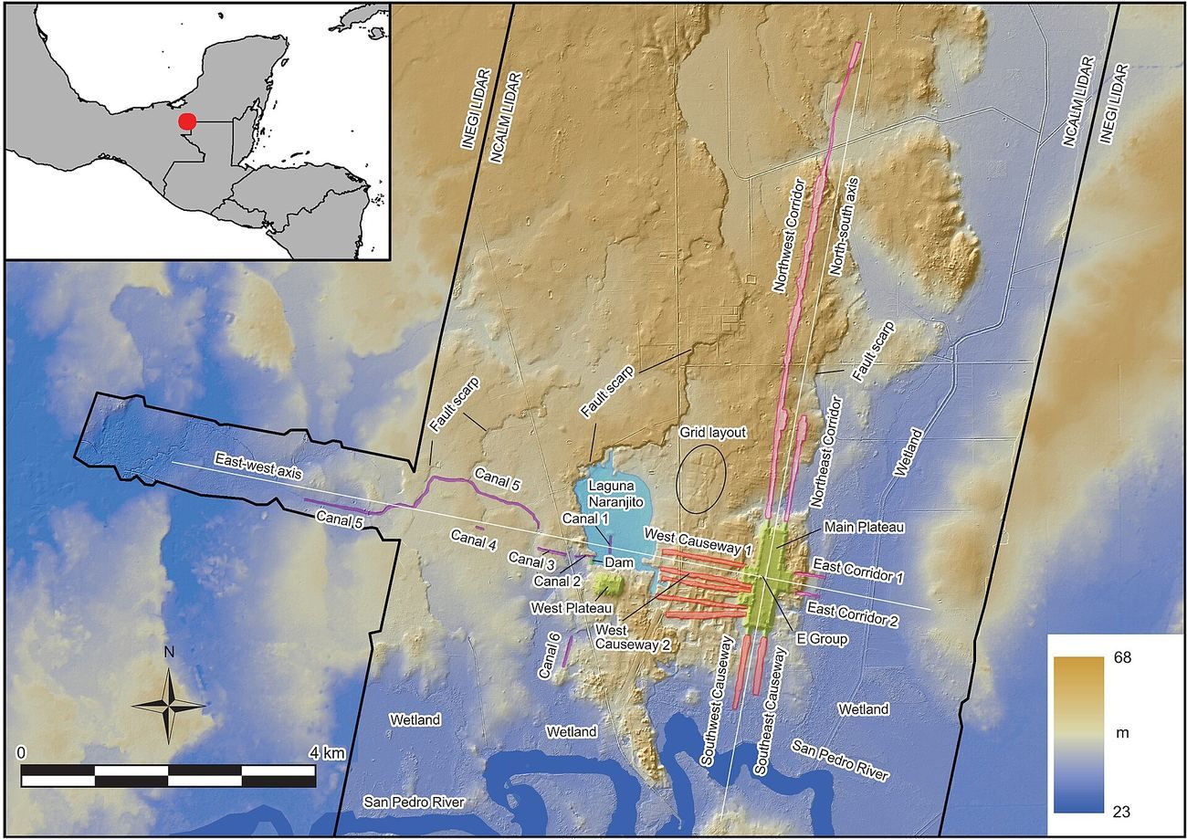

These results matter here for one reason. They show that standardized ceremonial plans with solar orientations were being built across southern Mesoamerica at the time INAH says Teteles was built. They also show how such a date is normally established: the Nature abstract for Aguada Fénix says its construction was dated using a Bayesian analysis of radiocarbon dates. The sources reviewed for Teteles do not report any radiocarbon date.
§ 5What INAH says the Teteles complex is
Claimed. According to the bulletin, the Group E at the site, called Tetelihtic by the project, lies east of the Great Plaza of the ceremonial precinct. It consists of a square patio flanked by two platforms, one at the east end and one at the west. The eastern one is elongated, measuring 90 metres from south to north and 40 metres from east to west. The western one is smaller, 46 metres from north to south and 27 metres from east to west, and is described as the observation point.
Diez Barroso Repizo is quoted as saying the layout is identical to those of the Maya area. He says that, like the Group E at Uaxactún, which the Teteles complex doubles in size, it is the oldest in Mexico, and that both date to the Middle Preclassic, 1000 to 600 BCE. He told The Art Newspaper a narrower version: that the complex is the first of its kind identified in northern Puebla, "though La Venta's Olmec complex may be older."
The bulletin then makes a distinction that sets the project's reading apart from the older Uaxactún tradition. It quotes him as saying the long platform does not mark the equinoxes at its centre. Instead, it served to fix the start of the pre-Hispanic Mesoamerican calendar in February and the harvest in October, "which makes it a complex and unique element." The eastern platform is also said to function as a solar calendar. The bulletin says observations confirmed that, standing in front of it at dawn, one can follow the path of the sun at the start of the equinoxes and solstices.
Interpretation. The statements are not consistent on one point. The bulletin says the long platform does not mark the equinoxes at its centre, and also says the sun's path can be followed at the start of the equinoxes and solstices. The two statements may be compatible, since a platform can mark a range of sunrise positions. But the bulletin gives no sunrise dates, no compass bearings and no horizon profile, so a reader cannot check either one. The bulletin's photographs, credited to Alberto Diez, include a sunrise seen from the observatory in February and views of the east and west structures at the spring equinox. The captions do not give measured alignments.
The bulletin's wording also runs ahead of the evidence it presents. Its headline says INAH "confirms" the existence of an observatory, and its text says the project has "proved" (comprobado) the function on the basis of comparative analyses of urban planning. A comparison of layouts can show that a complex resembles others. It does not by itself show how people used the buildings.
§ 6How the date was reached, and how it has moved
The date is the weakest part of the claim, and it is the part the sources say least about. The bulletin states that the complex dates to the Middle Preclassic, between 1000 and 600 BCE. It says Tetelihtic was in use between the Middle Formative, about 900 BCE, and the Protoclassic, about 100 CE. It does not say what evidence supports these figures. No radiocarbon measurement, ceramic sequence or stratigraphic section is cited. The Art Newspaper gives the Middle Preclassic range as 900 to 600 BCE and quotes the director saying the site declined around 100 CE, possibly because nearby Cantona expanded.
Earlier INAH publications about the same site give different chronologies. In the 2017 article, the first-season ceramics were assigned to the Late Formative, and the author names the Sotolaco type, known from the north of the Oriental Basin. INAH's 2022 article is more specific. It says that the first-phase test pits produced a tentative chronology by comparison with ceramics from other regions, with a high frequency of the Sotolaco phase, dated to the Late Formative between 400 BCE and 200 CE. It says Classic-period material was almost absent and that the upper layers held Epiclassic pottery of the Maxtlaloyan type.
The March 2024 bulletin said that finds in Structure 2 suggested an age of more than 3,000 years, in the same sentence as the end of the Middle Formative about 600 BCE, which is about 2,600 years before 2026. It placed the peak in the Protoclassic, from 200 BCE to 100 CE. INAH's November 2024 bulletin said the site had its greatest flourishing between 200 BCE and 100 CE, in the Terminal Formative, followed by an abandonment of more than four centuries. The 2026 bulletin moves the Group E back to 1000 to 600 BCE.
One more item belongs in the record. A 2017 abstract by Diez Barroso Repizo for the annual meeting of the Society for American Archaeology carries the title "Cultural practices and trade routes in the Sierra Norte of Puebla during the Middle Formative." The abstract says the first systematic excavations, in 2015, identified elements and cultural practices that place the settlement in an early period for the region. It gives no dates.
Confirmed, with a limit. All of these statements come from INAH, and they differ. The older ones are based on comparing pottery with regional sequences. The 2026 statement does not say what its date is based on. It is possible that the Group E is much older than the pottery found in test pits, since buildings can be older than the debris found around them. But a reader cannot tell from the bulletin whether that is the argument, and no radiocarbon date for the complex was found in the INAH publications reviewed for this story.
A related point comes from Šprajc's paper. It describes the Group E at Uaxactún, citing excavation reports, and says the earliest version of its western pyramid was built at the beginning of the Late Preclassic, between 300 and 100 BCE. It also says the eastern platform did not reach its present dimensions until the Early Classic, in the fourth century CE. The 2026 bulletin says the Uaxactún complex dates to the Middle Preclassic, between 1000 and 600 BCE. This reporter did not find a source that reconciles the two statements, and the bulletin does not cite one.
§ 7What outside scholars say
The Art Newspaper's report, published on October 26, 2026, by Constanza Ontiveros Valdés, is the only independent coverage found that quotes an outside expert. It quotes Šprajc, an archaeoastronomy specialist at the Research Centre of the Slovenian Academy of Sciences and Arts in Ljubljana, on three points.
Interpretation. First, he places Teteles within a broader tradition. He says previous archaeoastronomical studies using lidar have documented similar and earlier complexes along the southern Gulf and Pacific coasts, some dating to the late Early Preclassic, before 1000 BCE. That bears directly on the claim that Teteles is the earliest such complex outside the Maya area. Whether those complexes count as being outside the Maya area is a matter of definition, but they are not in Puebla and they are earlier.
Second, he is cautious about the word observatory. He says the common practice of calling these complexes observatories is not entirely justifiable. In his words, they contain astronomical alignments, but their primary functions were ceremonial or residential, and such alignments were commonly incorporated in very different types of structures throughout Mesoamerica. He adds that solar alignments tied to the ceremonial agricultural cycle were common, though the calendar year's start shifted over time.
Third, the same view runs through his 2021 paper, which was not written about Teteles. In it he argues that E Groups were built primarily for ritual purposes but were astronomically functional. Only their central east-west axes seem to have been laid out on astronomical grounds. He found no support for the idea that the complexes were used for particularly sophisticated observations. He concludes that "the designation 'astronomical observatory,' applied to E Groups or any other type of Maya structures, is unwarranted and implies a biased and partial interpretation of their primarily ritual, residential, funerary or administrative functions."
His paper also bears on the equinox language. He writes that the equinoxes are not directly observable, because they are defined by the geometry of Greek astronomy. He says there is no compelling evidence that the Maya and other Mesoamericans were aware of them. In his data, near-equinox alignments more likely targeted the quarter-days, which fall two days before or after the equinoxes. The 2026 bulletin avoids saying the long platform marks the equinoxes at its centre. But it does speak of following the sun at the start of the equinoxes and solstices. Whether Šprajc would apply his general argument to Teteles is not stated in the coverage. His comment to The Art Newspaper is the only reaction on record.
Interpretation. Šprajc also reports that many E Groups are not aligned to the solstices and equinoxes at all. In his sample, the most common alignments pointed to dates in the agricultural calendar that are separated by multiples of 13 and 20 days, the building blocks of the 260-day count. The most prominent peak in his E Group data is the pair March 11 and October 2, 160 days apart. A pair of February 12 and October 30, 260 days apart, appears as a smaller peak. A February and October pair of the kind the project describes at Teteles would be consistent with the general practice of marking dates in the agricultural year. But the project has not published its dates, so no comparison is possible.
§ 8Canopus, a goddess and an oral tradition
The project's earlier statements add a stellar element. INAH's 2024 bulletins say the main pyramid, Structure 1, aligns with Canopus, the second brightest star in the night sky. They say the star is visible only in February, the date on which the agricultural cycle began. This reporter did not test that statement. In the March 2024 bulletin, the project director ties this to an oral tradition collected by the local chronicler of Yaonahuac, Cirilo Salazar Morenos. According to that tradition, the alignment relates to veneration of the goddess Nantehuitz, "our mother of the south," to whom the ancient inhabitants left offerings of obsidian.
The 2026 bulletin repeats the possible link to Nantehuitz and to the orientation of the major structure toward Canopus. The Art Newspaper quotes Diez as saying the pyramid, about 12 metres tall, "may be aligned with Canopus," and that although scholars have studied this alignment in Mesopotamian and Egyptian structures, its meaning in Mesoamerica remains underexplored.
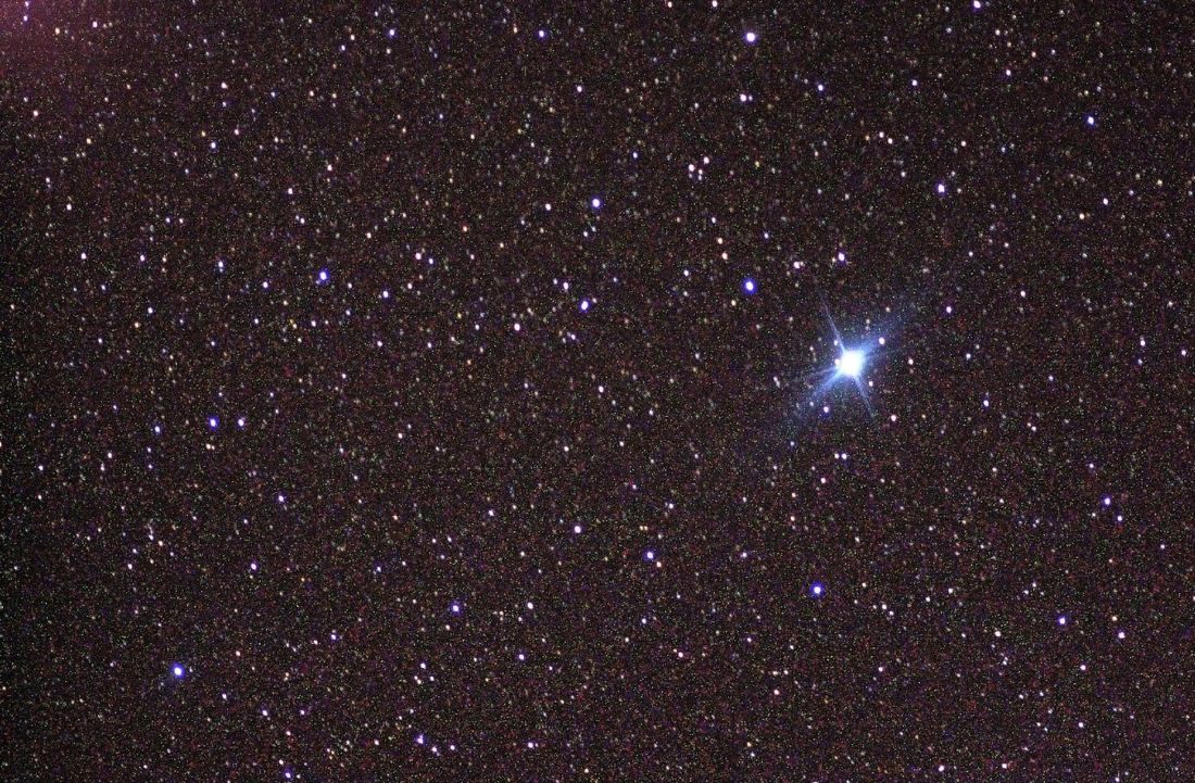

Claimed. The alignment of Structure 1 with Canopus, its association with the start of the calendar, and its link to a goddess named in a modern oral tradition are all claims by the project director. The word "may" in The Art Newspaper's quotation is his own.
Interpretation. Linking the name of a goddess the bulletin calls Nahua, recorded from a local oral tradition, to a monument that the project dates to 900 BCE or earlier is a large step. The bulletin does not explain how a name from a Nahuatl-language tradition would bear on a site that, in INAH's account, was partly abandoned by about 100 CE. The link is a hypothesis and is offered as one. Šprajc's 2021 paper found stellar explanations for E Group alignments unconvincing or questionable in the cases he measured, but it did not study Teteles.
The Art Newspaper article also says the site's main structures show several phases of occupation. That matters for any alignment claim. Šprajc's paper shows, for Uaxactún, that an alignment can only be tested against the building phases that stood together. He writes that the alignments proposed for Group E there connect buildings from different periods and so could not have been observationally functional. The question for Teteles is the same. Which buildings, in which phase, were in use together, and when?
§ 9Language, culture and what the site may say about it
Claimed. The bulletin makes a cultural claim as well as an astronomical one. The project director says the finding supports the Maya ethnolinguistic affiliation of the Huastec groups, since a Maya presence at Teteles could go back a thousand years before the common era, "as the observatory seems to show." One of the bulletin's two opening bullet points says the site "would provide" (aportaría) data on the cultural relationship between Huastec and Maya groups at the dawn of settlement in the Sierra Norte.
Confirmed. Huastec, which its speakers call Tének, is a member of the Mayan language family. SIL Mexico describes it as a rather isolated Mayan language, with more than 120,000 speakers, in a region that includes parts of Veracruz, Hidalgo, San Luis Potosí and Tamaulipas.
Interpretation. The Mayan affiliation of Huastec is not in question. What is in question is whether a building plan at Teteles shows that Huastec or other Mayan speakers lived there around 1000 BCE.
Claimed. The project's second principal hypothesis, repeated in the 2024 and 2026 bulletins, is that Teteles may hold the beginnings of Totonac culture. Diez Barroso Repizo supports it with later evidence. He says several offerings on the periphery of the ceremonial precinct date to 100 to 600 CE, which shows the place continued as a cult site after being partly abandoned. He also cites a Totonac offering dated to 600 to 900 CE found in one of the platforms. In the November 2024 bulletin, he described a pit in Structure 2 that held charcoal, pottery fragments and part of a stone palma in the form of a serpent. A palma is a type of sculpture that, with the yoke and the axe, characterizes Totonac culture, according to INAH. The pit was linked to pottery of the Maxtlaloyan type in the Epiclassic, between 650 and 900 CE.
From these, the project concludes that the original inhabitants were ancestors of the Totonac groups that later formed at Yohualichan, in Cuetzalan, Puebla, and at El Tajín, in Veracruz. The Art Newspaper quotes Diez as saying Totonac ceramic offerings and a sculpture fragment dated 600 to 900 CE suggest that later groups regarded the earlier inhabitants as their ancestors.
Interpretation. The two hypotheses sit side by side without being reconciled in the coverage reviewed. Totonacan is a language family separate from Mayan. SIL Mexico lists it as its own family, covering Totonac and Tepehua languages spoken in Puebla, Hidalgo and Veracruz, and says recent evidence links it with the Mixe-Zoquean family. A site cannot easily be an early Mayan outpost and also the cradle of Totonac culture unless the project means that different groups used it at different times, or that people of different languages shared it. The bulletin does not say which it means. The offerings, by the project's own account, were left centuries after the main buildings, so they show that later people revered the place. They do not show who built it.
§ 10Why the claim matters if it holds up
Interpretation. If the project's account is right, Teteles would add a Middle Preclassic ceremonial complex in the Puebla highlands to a picture of early Mesoamerica that already has several centres. The picture comes from the Ceibal, Aguada Fénix and Gulf Coast work cited above, in which standard ceremonial plans spread among communities across a wide area in the centuries after 1000 BCE. A Puebla site would show the idea reaching a mountain region near an obsidian source and a possible trade route between the central highlands and the Gulf Coast.
The project director's 2017 abstract for the Society for American Archaeology meeting takes this line. It says the early elements and practices it identified help to clarify the relationship between the central highlands of Mesoamerica and the northern Gulf of Mexico before the rise of Teotihuacan.
Confirmed. The first systematic excavations at Teteles were done in 2015, and the project has published its preliminary results in INAH's own venues, including a 2017 article and a conference abstract. INAH's 2022 article places the site between the Gulf Coast and the Oriental Basin, near the Zaragoza-Oyameles obsidian source, on a possible trade route. INAH has said it plans a site museum, and The Art Newspaper reports plans to open the site to the public, with no timeline.
Interpretation. The strongest version of the story is that an early ceremonial plan with astronomical alignments existed in highland Puebla. That would be significant even if "observatory" is the wrong word, and even if the date turns out to be a few centuries later. The weakest version is the one in the bulletin's headline and opening, that the observatory has been "confirmed" and that it is the first outside the Maya area. Both parts of that sentence depend on evidence not yet in the public record.
§ 11What remains open
Several things would settle the questions. The first is a radiocarbon series from charcoal or other organic material sealed in the construction fill of the eastern and western platforms. Radiocarbon dating is how Aguada Fénix was dated. The bulletin does not report any for Teteles. Without them, the Middle Preclassic date for the Group E rests on the project's comparison with other sites.
The second is a published alignment survey. Archaeoastronomers need azimuths and horizon altitudes measured from the actual observation points, with error estimates, to identify which sunrise dates a structure marks. The project says the layout is oriented 15 degrees east of magnetic north and that the east structure allows the sun to be followed through the year. Neither claim can be checked until the measurements are released. Šprajc's 2021 paper shows the standard to be met. It reports measured alignments for 71 E Groups, with the dates they mark, so that a new case can be compared.
The third is the building sequence. The Art Newspaper reports that the site's structures show several phases of occupation. A measured alignment is only meaningful for a building phase that was standing and visible at the same time as its partner. In the material reviewed, the project has described work on Structures 1 and 2, but not the building sequence of the Group E.
The fourth is peer review. The project's preliminary results were published in INAH's journal in 2017 and presented at a conference that year. The 2026 claim came by press bulletin. The coverage reviewed does not mention a journal article that sets out the evidence for the observatory, the date or the first-outside-the-Maya-area statement. If one is in preparation, it has not been announced.
The bulletin itself carries one qualification. Its first opening bullet point says the astronomical complex "would be" (sería) the only and oldest registered in former Mesoamerica outside the Maya area, comparable to Uaxactún. The conditional is the institute's own, and readers should keep it in mind when they see the claim restated as fact.
What can be said now is limited and clear. INAH and its project director say they have identified a Group E complex at Teteles de Ávila Castillo that served as a solar observatory more than 2,500 years ago. The site is real, the project is long-running, and its layout descriptions are specific. The date, the astronomical function and the claim of priority are claims, and the one outside specialist quoted so far says the common use of the word observatory for such complexes is not entirely justifiable. The evidence that would decide the question has not yet been published.
Watch & Listen
Hear this entry read aloud. Coming soon — the channels are not live yet.
Sources
The Teteles de Ávila Castillo claim: announcement and coverage
- INAH (in Spanish) – Boletín 471, "Confirman existencia de un observatorio solar prehispánico en Teteles de Ávila Castillo, Puebla" (October 13, 2026), the primary statement for the claim: inah.gob.mx/boletines/confirman-existencia-de-un-observatorio…
- INAH (in Spanish) – Boletín 471, PDF version of the same statement: inah.gob.mx/images/boletines/2026/471/Boletin_471.pdf
- La Jornada Maya (in Spanish) – republication of the INAH bulletin (October 13, 2026): lajornadamaya.mx/nacional/269494/confirman-existencia-de-un-o…
- The Art Newspaper – Constanza Ontiveros Valdés, "2,500-year-old solar observatory discovered in Mexico" (October 26, 2026), the only coverage found that quotes an outside expert: theartnewspaper.com/2026/10/26/2500-year-old-solar-observator…
Earlier project publications by INAH (all in Spanish)
- INAH Arqueología – Alberto Diez Barroso Repizo, note on the Teteles de Ávila Castillo project (October 18, 2022): arqueologia.inah.gob.mx/publico/notas_especificas.php?id=OTg%3D
- Arqueología (INAH journal) – Diez Barroso Repizo, 2017 note on the first seasons at Teteles de Ávila Castillo: revistas.inah.gob.mx/index.php/arqueologia/article/view/13162
- INAH – Boletín, "Los secretos de Teteles de Ávila Castillo, sitio temprano de la Sierra Norte de Puebla, se revelarán en un museo" (November 4, 2024): inah.gob.mx/boletines/los-secretos-de-teteles-de-avila-castil…
- INAH – Boletín 167 (March 22, 2024), PDF: inah.gob.mx/images/boletines/2024/167/Boletin%20167.pdf
- Digital Archaeological Record (tDAR) – Diez Barroso Repizo, "Cultural Practices and Trade Routes in the Sierra Norte of Puebla during the Middle Formative: Archaeology of the Teteles de Ávila Region," Society for American Archaeology meeting abstract (2017): core.tdar.org/document/429016/cultural-practices-and-trade-ro…
Background: E Groups and early Mesoamerican ceremonial architecture
- PLOS ONE – Ivan Šprajc, "Astronomical aspects of Group E-type complexes and implications for understanding ancient Maya architecture and urban planning" (April 27, 2021; open access): journals.plos.org/plosone/article?id=10.1371%2Fjournal.pone.0…
- Science – Takeshi Inomata and colleagues, "Early Ceremonial Constructions at Ceibal, Guatemala, and the Origins of Lowland Maya Civilization" (2013); abstract read through PubMed, as the Science page was not opened: pubmed.ncbi.nlm.nih.gov/23620050/
- Nature – Takeshi Inomata and colleagues, "Monumental architecture at Aguada Fénix and the rise of Maya civilization" (June 3, 2020): nature.com/articles/s41586-020-2343-4
- Science Advances – Takeshi Inomata and colleagues, "Landscape-wide cosmogram built by the early community of Aguada Fénix in southeastern Mesoamerica" (November 7, 2025); abstract read through PubMed: pubmed.ncbi.nlm.nih.gov/41191744/
- University of Arizona News – Kyle Mittan, "U of A-led team discovers large ritual constructions of early Mesoamericans" (November 5, 2025): news.arizona.edu/news/u-led-team-discovers-large-ritual-const…
- SIL Mexico – "Confusing Huasteco" (Huastec, or Téenek, as a Mayan language): mexico.sil.org/publications/confusion-of-names/confusing-huas…
- SIL Mexico – "Totonacan" language family: mexico.sil.org/language_culture/totonacan
Image sources
- Wikimedia Commons – Atempan, Sierra Norte de Puebla (Leti Padilla, CC BY-SA 4.0): commons.wikimedia.org/wiki/File:SIERRA_NORTE_DE_PUEBLA_MUNICI…
- Wikimedia Commons – Uaxactún Group E from the Temple of the Masks (Davidgermain, CC BY 3.0): commons.wikimedia.org/wiki/File:Uaxactun_GroupE_fromTempleOfM…
- Wikimedia Commons – Canopus, photographed from the International Space Station (NASA, public domain): commons.wikimedia.org/wiki/File:Canopus.jpg
- Wikimedia Commons – Map of Aguada Fénix, from Inomata and colleagues, Science Advances 2025 (CC BY 4.0): commons.wikimedia.org/wiki/File:Map_of_Aguada_F%C3%A9nix.jpg
