Space
The Viral Satellite Photo Over Mount Taranaki Is Real. Here Is What It Shows, and What It Doesn't
By Darrell Wallen
Would you prefer to listen?
A photo of the night sky over Mount Taranaki in New Zealand is full of satellite trails. Its maker thinks it holds about 14,000 trails from about 1,400 satellites. Tens of millions of people have seen it since mid-October 2026. Many online called it fake and made by AI. It is not.
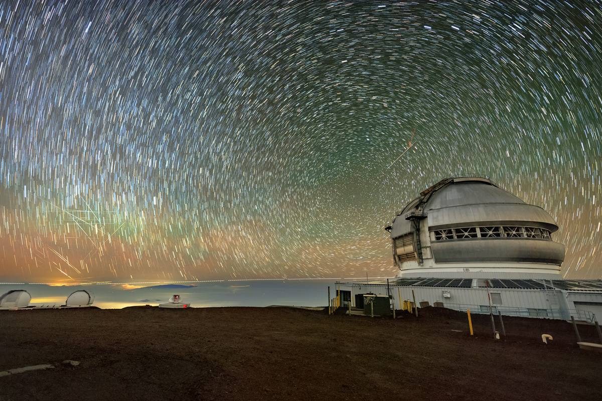
Photographer Brendan Larsen built it from 578 real photos taken over almost two hours on September 9. Then he spent about 45 hours putting them together by hand. Because it is many photos in one, it does not show what you would see if you looked up on one night. But it does show how crowded the space near Earth has become. Astronomers say that crowding is already hurting their work.
The Guardian reported the story on November 3, 2026. It said the image won Larsen about 15,000 new followers and about 10,000 comments on his Facebook page.
Larsen is 51. He told the paper what nine out of ten comments say. They are something like "Wow, beautiful photo, but horrifying, terrifying and really concerning about what's happening to the night sky."
§ 1How the photo was made
Larsen is a teacher in New Plymouth. He took up night-sky photography about six years ago, according to New Scientist.
On the evening of September 9, 2026, he set up his camera near Norfolk, a farm area north of Midhirst in Taranaki. He used a Canon EOS R with a 50-millimeter Sigma lens and aimed it at the mountain. In his own post, he says each shot lasted eight seconds. His settings were f/2 and ISO 6400, which help a camera catch faint light.
The camera ran from 8:18 p.m. to 10:13 p.m. local time. Each eight-second shot was followed by a two-second gap. That made 578 photos.
"I left her running for two hours and captured 578 photos," he told the Guardian. "That was the easy part."
The hard part was the editing. Larsen said each photo held about 25 satellites on average. He stacked the photos in Adobe Photoshop and added each satellite trail by hand.
Much of the 45 hours went to removing the stars. The Earth turns, so over two hours the stars slowly drift across a fixed camera. They would have left curved streaks of their own. Larsen took those out and kept one still view of the sky behind the satellites.
The image also hides a smaller story. The tiny row of lights on the side of the mountain is two climbers. They were coming down Taranaki in the dark, Larsen said. Their headlamps were caught photo by photo as they walked toward Tahurangi Lodge.
§ 214,000 trails, but not 14,000 satellites
The numbers in this story are easy to mix up. Larsen has been careful about them himself.
He sells prints online. On that page, he writes that there are "approximately 14,000 satellite trail appearances across the 578 photographs." He adds: "These aren't necessarily 14,000 different satellites, as the same satellite can appear in multiple exposures."
That is because a satellite may take about a minute to cross the frame. So it can show up in several eight-second shots in a row. In his first social media post, Larsen guessed there were about 14,450 trails, made by about 1,400 different satellites.
New Scientist made the same point. The image does not mean 14,000 satellites flew past in two hours, it said. Those counts are Larsen's own estimates. No outside group has counted the trails.
So how many satellites are up there? The Guardian put the number of working satellites at about 16,000. There are also tens of thousands of dead spacecraft, used rocket parts and bits of junk.
The Taranaki Daily News cited the tracking site Orbital Radar. It counts 15,870 satellites, and 10,081 of them belong to SpaceX's Starlink network. The American Astronomical Society says there are more than 15,000 satellites in low Earth orbit in 2026. Low Earth orbit is the part of space closest to Earth.
The International Astronomical Union is the world's main group of astronomers. Its dark-sky center counts 11,672 working satellites in the big fleets alone. Those are fleets planned to have more than a thousand each. Each source counts a bit differently. But they agree on the size, about 15,000 to 16,000 working satellites.
The union says that number has shot up since 2019. Its center also lists 36 big fleets being planned. Together they would add up to more than 2.3 million satellites. Those are only plans on paper, and the union calls that number an upper limit. It says experts expect perhaps 50,000 to 100,000 working satellites within ten years.
§ 3Why people thought it was AI, and why it isn't
Larsen expected people to say it was fake. So he filmed himself editing, partly to show how he made it.
"AI generating software is becoming so good it is becoming difficult to tell AI images from real images," he told the Guardian, "especially if you're not familiar with the location or with astrophotography." He said the claims were frustrating. He also said people had downloaded his image and remade it with AI tools. Those copies had clear mistakes.
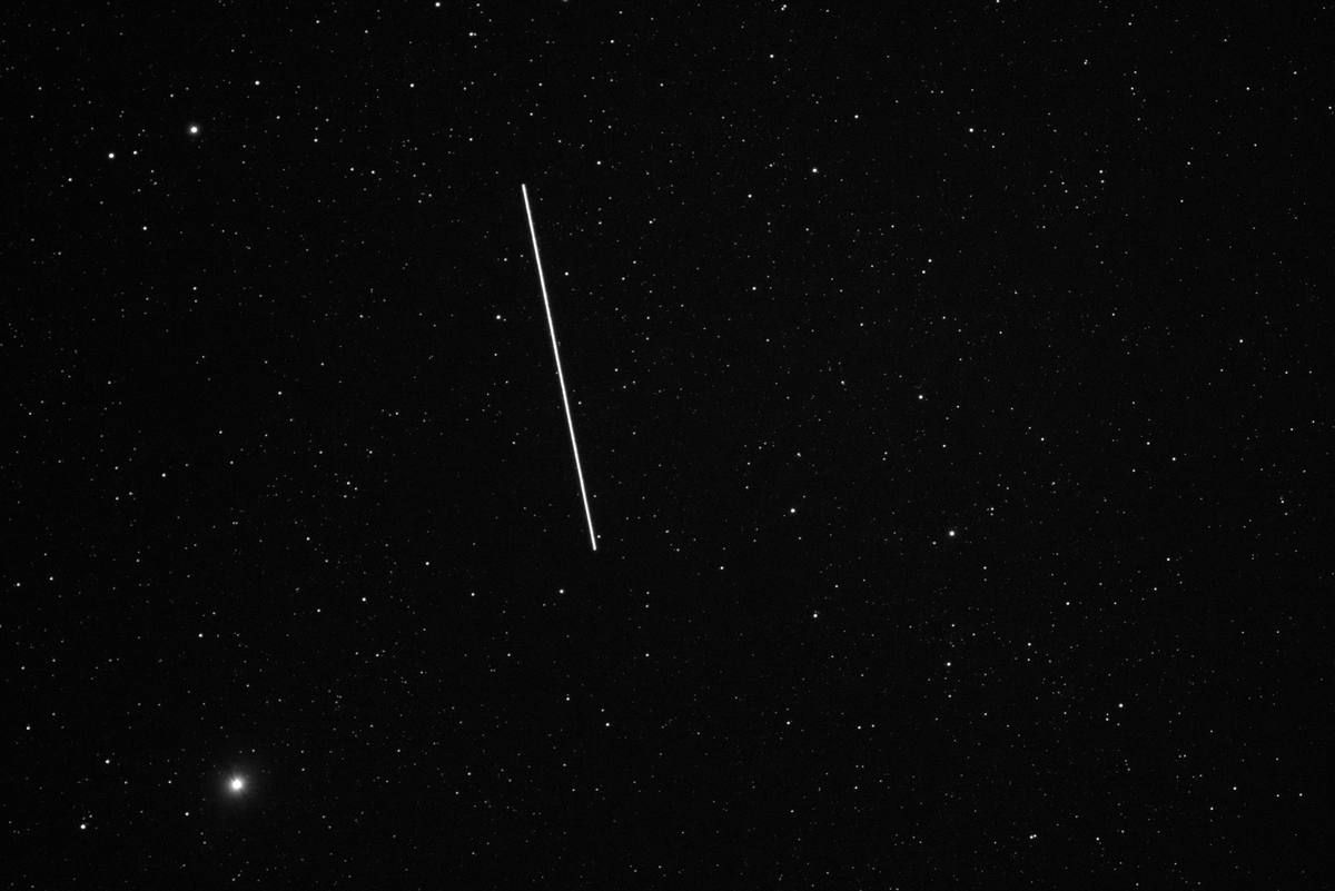
There are good reasons to believe the photo is real. Larsen shared his camera, lens, settings, date, times and place. He released one eight-second photo, which New Scientist printed. It shows only a few trails.
He also made a time-lapse video from the same photos. The Taranaki Daily News said that video alone reached about six million views. And the result matches what astronomers see with their own cameras. Big telescopes have caught these streaks in long photos since the first big fleets launched in 2019.
Plainly put, the photo is a composite. That means many photos stacked into one, here almost two hours of sky. It is a normal method in night-sky photography, like classic star-trail photos. But it can fool anyone who thinks they are seeing one moment.
§ 4What the naked eye sees
So would you see a sky like this from a dark field in Taranaki? No.
Larsen himself told the Guardian that satellites "don't yet overwhelm the sky to the naked eye." NSF NOIRLab is the U.S. national center for star study from the ground. It says most satellites in the big fleets are too faint to see by eye. That is even more true where city lights brighten the sky. Cameras and telescopes pick up much fainter light than eyes can.
Timing matters too. You can only see a satellite when sunlight hits it while the ground below is dark. That happens most in the first few hours after sunset and before sunrise, the Rubin Observatory says. That is when Larsen's camera was running. Later at night, many satellites pass through Earth's shadow and leave no trail.
On a good evening, a patient person in a dark place will often see a few satellites drift by. Larsen's camera, working for two hours without a break, caught about 25 in each photo. The composite adds them all up.
§ 5What the trails do to professional astronomy
For astronomers, satellite trails are not about looks. A bright streak across a photo can wipe out the faint stars and galaxies behind it.
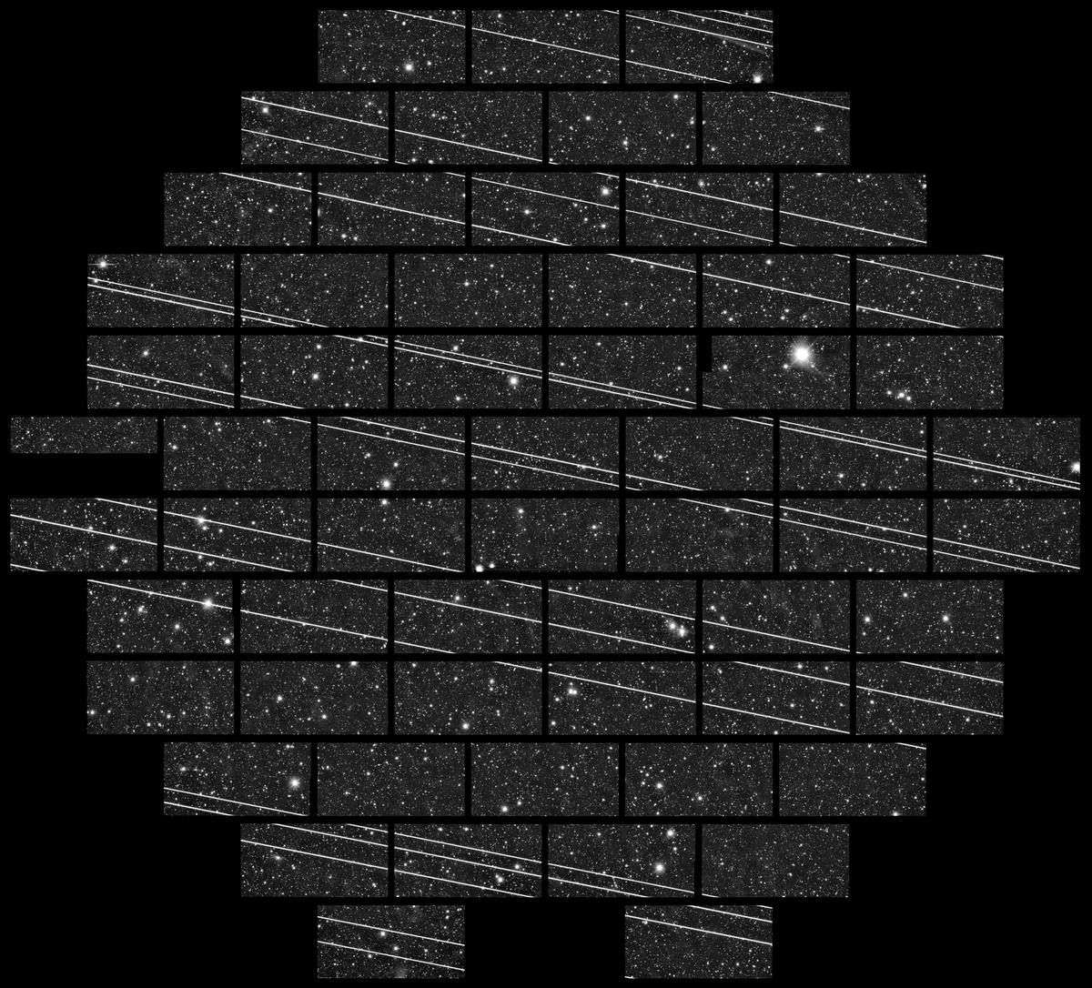
The first big public warning came in November 2019. Astronomers in Chile were using the Dark Energy Camera on the Víctor M. Blanco Telescope. They found at least 19 streaks in a single photo that took 333 seconds, NOIRLab reported. They traced them to a group of Starlink satellites launched the week before.
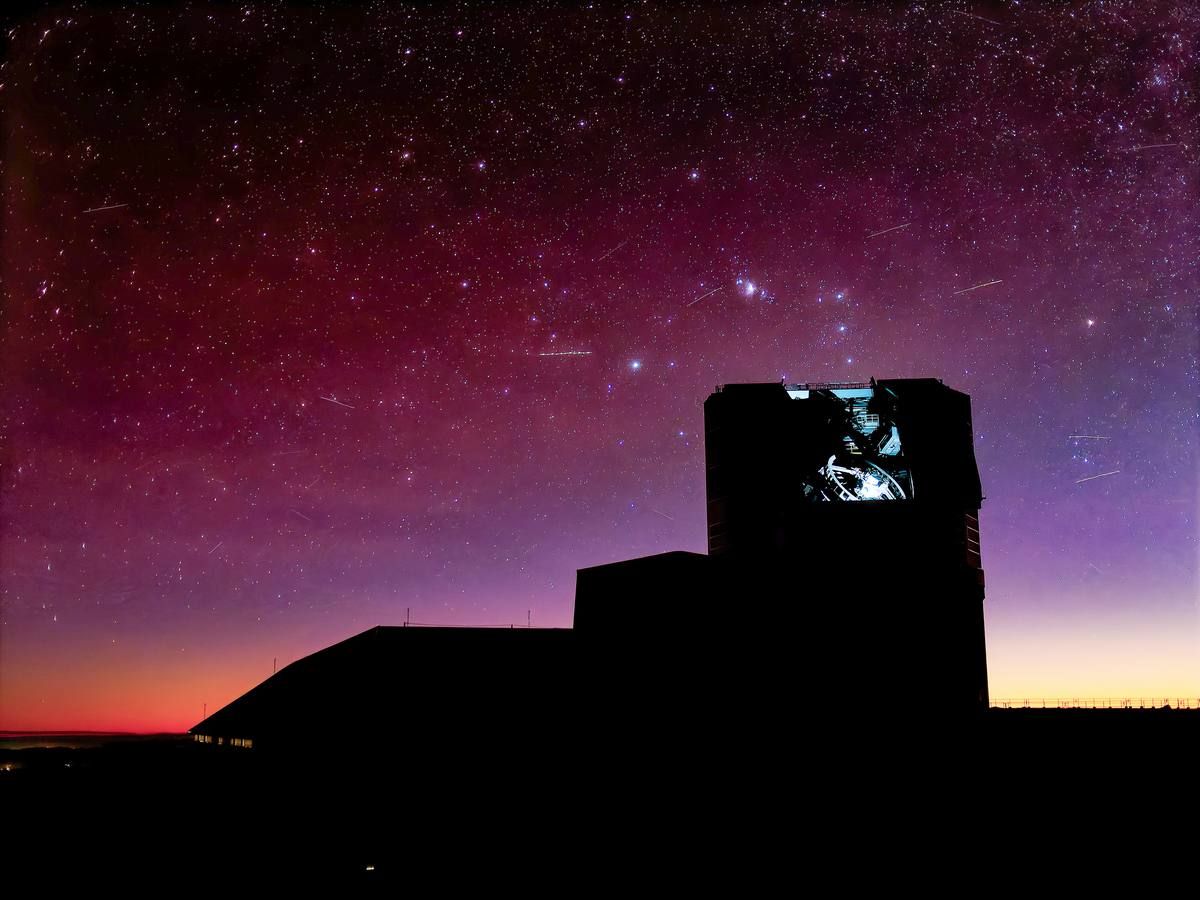
The Vera C. Rubin Observatory in Chile is at special risk. In June 2026, it began a ten-year survey of the sky. It takes a photo of a wide patch of sky about every 30 seconds. A low satellite can cross the whole view in one shot.
The observatory ran computer tests with 40,000 satellites in low orbit. About 10 percent of all Rubin photos would have at least one trail, it found. So would most photos taken at dusk and dawn. Rubin warns that the hunt for dangerous space rocks coming from the Sun's side of the sky would suffer most. That part of the sky can only be searched at dusk and dawn. Rubin's software now marks and hides streaks, so they stay out of its final images and nightly alerts.
The pressure keeps growing. There is a plan for about one million satellites that would work as computer centers in space. An October 2026 study looked at what that would do. It was posted on the arXiv website and has not yet been checked by other scientists. It found that on some nights, up to 80 percent of Rubin's photos would have a bright streak. Over a year, the average would be about 20 percent.
In 2026, the International Astronomical Union spoke to a United Nations committee. It said careful tests show the danger. One million satellites in low orbit "would make ground-based optical astronomical observations essentially impossible," it said. In plain words, telescopes on the ground could hardly work.
§ 6Even Hubble gets photobombed
Telescopes in space are not safe either. In 2023, a team led by Sandor Kruk looked through Hubble Space Telescope photos taken from 2002 to 2021. Volunteers and a computer program helped.
In the journal Nature Astronomy, the team said satellites crossed 2.7 percent of Hubble's photos. That share was rising. Hubble flies only about 320 miles up. So satellites higher up pass between it and what it is looking at.
A study in the journal Nature in December 2025 looked ahead. NASA researcher Alejandro Borlaff led it. What if the roughly 560,000 satellites in planned fleets were launched? Then about 40 percent of Hubble photos would have at least one trail, it found.
Three wide-view telescopes in low orbit would be hit harder. They are NASA's SPHEREx, the planned European ARRAKIHS mission and China's Xuntian. More than 92 percent of their photos would have trails. Those are guesses based on plans, not sure things. The James Webb Space Telescope sits about a million miles away, far beyond the satellite zone.
§ 7Radio telescopes hear them too
Radio astronomers face a different problem. Satellites talk to the ground by radio. Some also leak radio noise they are not meant to send.
In 2023, a team led by Federico Di Vruno of the SKA Observatory used the LOFAR radio telescope, based in the Netherlands. They listened to 68 Starlink satellites. In the journal Astronomy and Astrophysics, they reported stray radio signals from 47 of them. The signals were between 110 and 188 megahertz. That range includes a band set aside for radio astronomy. It is far from the signals the satellites use to talk to the ground.
A 2024 follow-up found that newer Starlink satellites leaked up to 32 times more of this signal than the first ones. Cees Bassa of ASTRON, the Netherlands Institute for Radio Astronomy, is one of the authors. "Compared to the faintest astrophysical sources that we observe with LOFAR, UEMR from Starlink satellites is 10 million times brighter," he said. UEMR is short for this kind of stray radio leak.
The researchers note that world rules limit the signals satellites mean to send. They do not cover this kind of leak.
§ 8Warnings about the upper atmosphere
When satellites wear out, most are steered down to burn up in the air. Scientists have begun asking what that leaves behind. Here the evidence is early. Read it as a warning, not as proof of harm.
In 2023, NOAA scientists led by Daniel Murphy flew tools high into the stratosphere on a research plane. That is the layer of air above where airliners fly. In the journal PNAS, they said about 10 percent of the tiny acid drops they sampled held aluminum and other metals. The metals came from rockets and satellites burning up as they fell. The share could grow to 50 percent or more as launches increase, the team said. What those metals do to the air is not yet known.
In 2024, a University of Southern California team led by José Ferreira used a computer model to study aluminum oxide. Burning satellites make this dust. In the journal Geophysical Research Letters, the team said falling satellites made about 17 metric tons of it in 2022. Once planned fleets are done, they put it at about 360 metric tons a year.
Aluminum oxide can help set off chemical reactions that destroy ozone, the study said. Ozone is the gas high up that shields us from the Sun's harmful rays. The team found the dust could take up to 30 years to drift down to where most ozone sits. That is a model result. No one has reported measured damage to the ozone layer from falling satellites.
The Guardian also noted a United Nations warning. More activity in space poses risks to safety on the ground, to dark skies and to astronomy, the UN has said.
§ 9What is being done
Astronomers are pushing for limits and for teamwork. NOIRLab and the SKA Observatory jointly host a center for the International Astronomical Union. Set up in 2022, it is called the Centre for the Protection of the Dark and Quiet Sky from Satellite Constellation Interference.
The center works with satellite companies on dimmer designs and better data on where they are. It builds software to predict and remove streaks. It also makes its case at a United Nations space committee. In May 2026, the science academies of the G7 nations put out a joint report, the center reported. It called for more rules on these fleets and a new world body to oversee them.
Some companies have made changes, and the American Astronomical Society says it is working with them. But it says that cutting harm "has largely been voluntary" so far. In other words, companies choose whether to do it. The society also says U.S. license rules give no thought at all to astronomy done with visible light.
Satellites do bring real benefits, such as internet in remote places, weather data and help in disasters. Astronomers say they want to share the sky, not ban satellites.
§ 10Confirmed and unconfirmed
Confirmed: Larsen's image is real. It combines 578 eight-second photos taken over Mount Taranaki on September 9, 2026. He put them together by hand in about 45 hours. About 15,000 to 16,000 working satellites are in orbit, depending on who counts. Satellite trails already affect telescopes on the ground and in space. Scientists have also measured stray radio signals from satellites.
Not confirmed: the exact number of trails and satellites in the image, which are Larsen's estimates. How bad things will get, which depends on how many planned satellites actually launch. And any measured harm to the ozone layer from falling satellites, which so far rests on early tests and models.
Larsen remembers all the stars over rural New Zealand when he was a child. He says he was "absolutely blown away" by them. He hopes his photo will start a talk about using satellites wisely. "We can raise awareness," he told the Guardian, "and through that get a groundswell of support for protecting the night sky."
In short, the viral photo is real, but it is two hours of sky packed into one picture. Your eyes would not see this many satellites at once. Cameras and telescopes do. And the number of satellites is still climbing fast.
Watch & Listen
Hear this entry read aloud. Coming soon — the channels are not live yet.
Sources
The photo
- Brendan Larsen Photography, "14,000 Satellite Trails over Mt Taranaki" (photographer's own description and print page): blarsenphoto.com/store/p/14k-satellite-trails
- Brendan Larsen Photography, original Facebook post (Oct. 2026): facebook.com/photo?fbid=1767311182069586&set=a.439530354847682 (Facebook blocks automated checks)
- The Guardian, Eva Corlett, "The night-sky image so incredible the NZ man behind it has been accused of using AI" (Nov. 3, 2026): theguardian.com/world/2026/nov/04/viral-image-nz-night-sky-sa…
- The Post / Taranaki Daily News, Will Johnston, "Taranaki night sky image revealing massive satellite numbers goes viral" (Oct. 25, 2026): thepost.co.nz/nz-news/361104682/taranaki-night-sky-image-reve…
- New Scientist, Alice Klein, "Photo of 14,000 satellite trails shows how busy space is becoming" (Oct. 28, 2026): newscientist.com/article/2595529-photo-of-14000-satellite-tra… (site blocks automated checks)
Satellite numbers and the dark-sky effort
- IAU Centre for the Protection of the Dark and Quiet Sky from Satellite Constellation Interference (home page and live counts): cps.iau.org/
- IAU CPS, "How do satellites affect astronomy?" (infographic): cps.iau.org/documents/364/IAU_CPS_INFOGRAPHICS_3.pdf
- IAU CPS, "G7 sciences academies call for action on satellite constellations" (June 9, 2026): cps.iau.org/news/g7-sciences-academies-call-for-action-on-sat…
- IAU statement to the UN COPUOS Scientific and Technical Subcommittee (2026): unoosa.org/documents/pdf/copuos/stsc/2026/Statements/Wednesda…
- American Astronomical Society, "Threats to Dark & Quiet Skies by Satellite Constellations" (2026): aas.org/sites/default/files/2026-09/AAS%20flyer-satellite%20c…
- NSF NOIRLab, "Stars and Satellites over Gemini North" (Oct. 8, 2025): noirlab.edu/public/images/iotw2541a/
Optical astronomy
- NSF NOIRLab, "Starlink Satellites Imaged from CTIO" (Nov. 13, 2019): noirlab.edu/public/images/iotw1946a/
- Rubin Observatory, "Impacts from artificial satellites and debris": rubinobservatory.org/for-scientists/frequently-asked-question…
- Rubin Observatory, "Legacy Survey of Space and Time (LSST)": rubinobservatory.org/explore/how-rubin-works/lsst
- "The Impact of Orbital Data Centers on the NSF-DOE Vera C. Rubin Observatory" (arXiv preprint, Oct. 2026, not peer reviewed): arxiv.org/html/2610.31772
- Kruk et al., "The impact of satellite trails on Hubble Space Telescope observations," Nature Astronomy (2023): nature.com/articles/s41550-023-01903-3
- Borlaff et al., "Satellite megaconstellations will threaten space-based astronomy," Nature (Dec. 3, 2025): nature.com/articles/s41586-025-09759-5
Radio astronomy
- Di Vruno et al., "Unintended electromagnetic radiation from Starlink satellites detected with LOFAR between 110 and 188 MHz," Astronomy & Astrophysics (2023): aanda.org/articles/aa/full_html/2023/08/aa46374-23/aa46374-23… (site blocks automated checks)
- Bassa et al., "Bright unintended electromagnetic radiation from second-generation Starlink satellites," Astronomy & Astrophysics (2024): aanda.org/articles/aa/full_html/2024/09/aa51856-24/aa51856-24… (site blocks automated checks)
- ASTRON, "Second-Generation Starlink Satellites Leak 30 Times More Radio Interference" (2024): astron.nl/starlink-satellites/
Upper atmosphere
- NOAA Chemical Sciences Laboratory, "NOAA scientists link exotic metal particles in the upper atmosphere to rockets, satellites" (Oct. 16, 2023): csl.noaa.gov/news/2023/388_1016.html
- Murphy et al., "Metals from spacecraft reentry in stratospheric aerosol particles," PNAS (2023): pnas.org/doi/10.1073/pnas.2313374120 (site blocks automated checks)
- AGU Newsroom, "Satellite 'megaconstellations' may jeopardize recovery of ozone hole" (2024): news.agu.org/press-release/satellite-megaconstellations-burn-…
- Ferreira et al., "Potential Ozone Depletion From Satellite Demise During Atmospheric Reentry in the Era of Mega-Constellations," Geophysical Research Letters (2024): agupubs.onlinelibrary.wiley.com/doi/10.1029/2024GL109280 (site blocks automated checks)